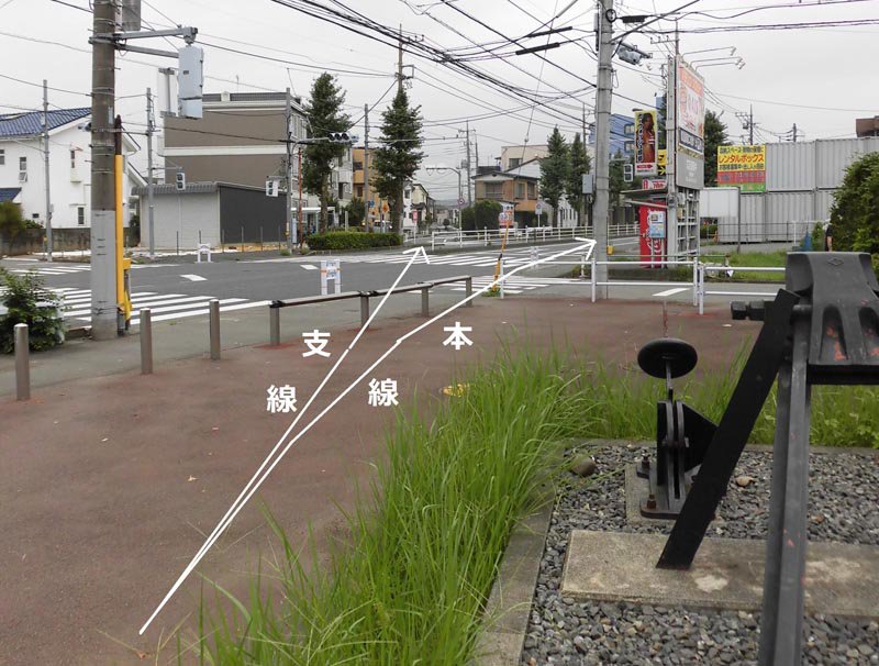
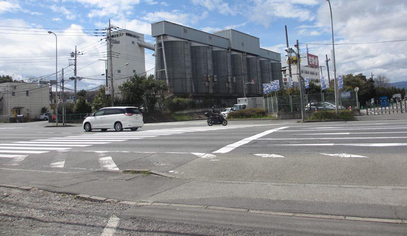
分岐点付近(画像④4。次ページ概念図①地点)
五日市鉄道本線跡から新奥多摩街道を撮影。
支線分岐点は武蔵田中駅の少し立川寄り。
右のモニュメントはほぼ当時の分岐点に置かれている。
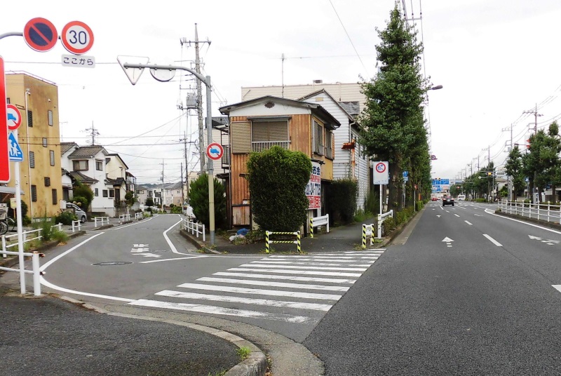
①地点(画像④5)
右が本線跡の新奥多摩街道、左が支線廃線跡の道路
①地点南
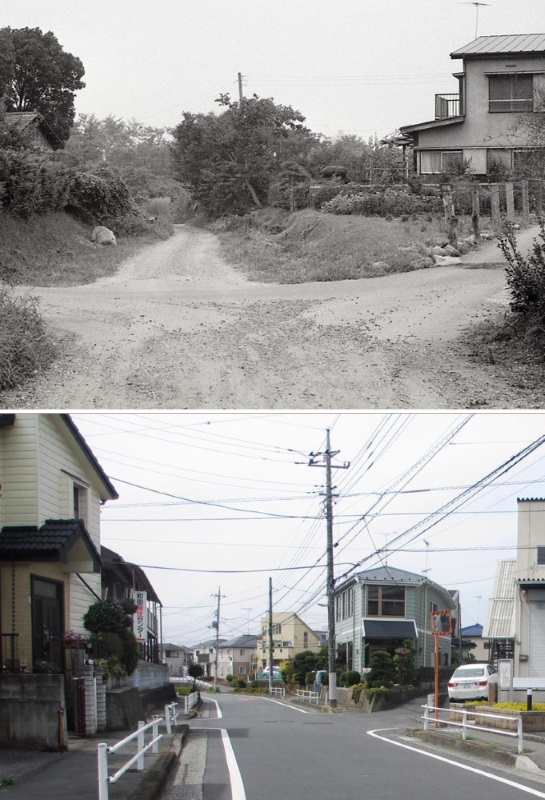
上(画像④6)は1975年佐藤美知男氏撮影。線路跡はまだ未舗装。南を写す。
下(画像④7)は現在の同地点。
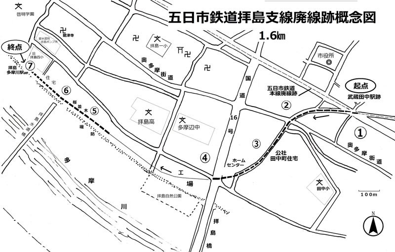
五日市鉄道拝島支線廃線跡概念図
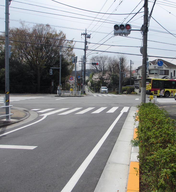
②地点 奥多摩街道を横切る(画像④8)
信号先が田中町住宅。
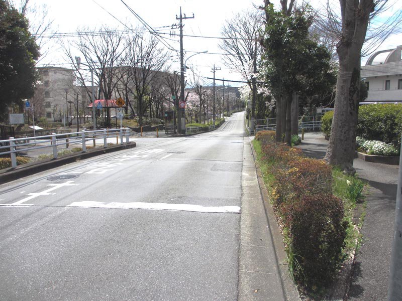
③地点 田中町住宅の西(画像④9)
南方向を撮影。左は田中町住宅。
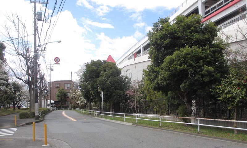
③地点の南 ホームセンター裏(画像④10)
道路は突き当りで左に曲がるが、線路は建物に沿って右にカーブしていた。
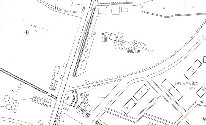
画像④11 ③④地点付近の住宅地図(1980年、ゼンリン)
田中町住宅の西に線路跡がくっきり。現ホームセンターは浅野セメントの工場である。
線路跡は拝島橋北交差点から、現在もある南西方向の生コン工場敷地に向かっている。
④地点 拝島橋北交差点(画像④12)
南西方向を写す。ホームセンター裏から続く線路跡は国道を斜めに横断し正面の生コン工場方向に。
その先の線路跡は工場敷地内に消える。
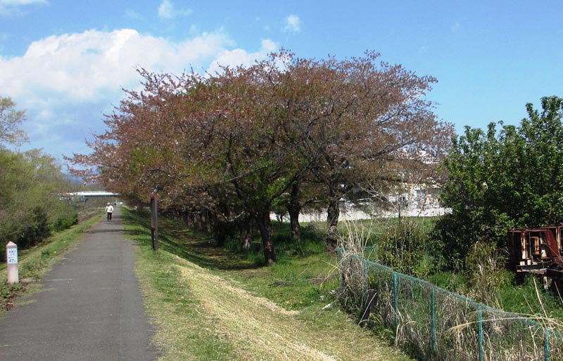
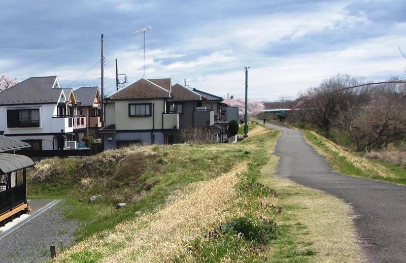
⑤地点 線路跡にできた桜並木(画像④13)
多摩川堤防を西に進むと第一石産関連工場敷地の西側に桜並木がある。左は多摩川堤防。河口から47㎞の地点である。
⑤地点(画像④14)桜並木
この並木にかつて線路があった。

⑥地点 砂利運搬トロッコ(画像④15。昭和10年代、澤井栄氏所蔵=口絵重複)
多摩川で採取した砂利を堤防先の拝島支線積換場へ運搬中。場所は現在水道橋が架かるところ。
しっかりとした橋をガソリン機関車が牽引している。
建物は機関車倉庫。(八王子市史叢書5「八王子写真民俗誌」掲載)。
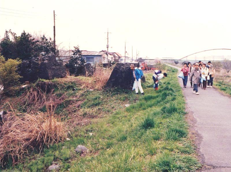
⑦地点 拝島支線の終点付近(画像④16。平成4年)
西から東を撮影。アーチ橋が拝島水道橋。
当時は堤防脇に線路の車止めとも思われる大きなコンクリート片がいくつか残っていた。
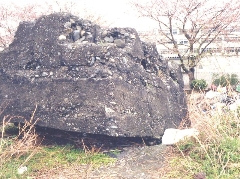
⑦地点(画像④17)
右と同じ日に撮影したコンクリート片。背後は旧拝島第四小。
⑦地点(画像④18)現在の終点付近 右上と同じ位置。