
When we look at Higashihiroshima City from the sky, the view varies by area.
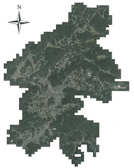 |
| Aerial picture of Higashihiroshima City |
Land seems to be used differently in different areas.
The altitude in Higashihiroshima City is higher in the north and lower in the south.
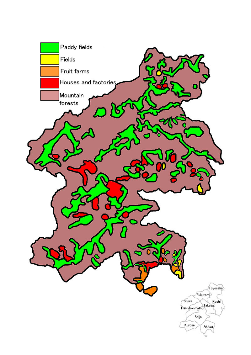
Land in Higashihiroshima City is mostly mountains and forests. Other land is used for a variety of purposes.
| What are the places outside of my town like? |  |
There are many rice farmers in Higashihiroshima City, so paddy fields spread throughout the city. Fields are located here and there.
In the south of the city, there are many fruit farms and fields of oranges, loquats, and potatoes.
Residential areas and factories cluster in the center of Higashihiroshima City.
| Let’s check the map to see how the land is used in each area of Higashihiroshima City. |  |
| There are many paddy fields in Higashihiroshima City. Paddy fields seem to be located along the rivers. Let’s compare this with the blank map. Where are houses and factories clustered? What is grown in the fields? Let’s find out more. |  |
Map of land use in Higashihiroshima City
 |