


 |
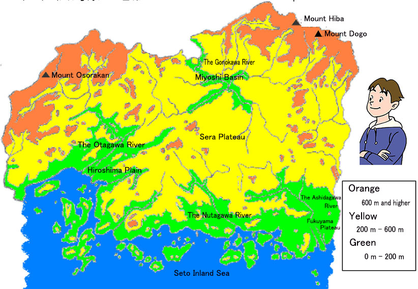
The Chugoku Mountains lie to the north of Hiroshima Prefecture, including mountains over 1,000 m tall, such as Mount Osorakan, Mount Hiba, and Mount Dogo. Miyoshi Basin is also located in the north of the prefecture, and the Gonokawa River flows to the Sea of Japan through Shimane Prefecture.
Plateaus, including the Sera Plateau, are located in the center of the prefecture. Higashihiroshima City is located on the Kamo Plateau in the south of the Sera Plateau.
Hiroshima Plain and Fukuyama Plain lie to the south. The Otagawa River, Nutagawa River and Ashidagawa River flow into the Seto Inland Sea.
| Write down what you find out about the geographic features of Hiroshima Prefecture using the topographical map. |  |