| 富士山栗原新田は享保十年(一七二五年)に富士山村名主栗原七右衛門によって開発が始められた。開発当初は富士山村・栗原新田であったが、明和九年(一七七二年)の検地で、富士山栗原新田と呼ばれ、現在に至っている。いうまでもなく、ここは幕府直轄で初期の代官は萩原源八郎であった。 | The development of Fujiyama Kurihara Shinden was started by the Fujiyama Village headman, Kurihara Shichi'emon, in Kyoho 10 (1725). Although at the beginning of its development it was Kurihara Shinden of Fujiyama Village, by the time of the Kenchi land survey in Meiwa 9 (1772), it was referred to as Fujiyama-Kurihara Shinden, and thus it has remained until now. Needless to say, it was a territory under the shogunate's direct control, and the initial 'daikan' was Hagiwara Genpachiro. |
| ○富士山栗原新田の小字のおこり | ○ Origins of the Ko-aza names of Fujiyama-Kurihara Shinden |
| 小字名は開発時から明和九年の間につけられたもので、それ以前にはこの辺一帯を西武蔵野、新町野、新町原、武蔵野入会秣場(いりあいまぐさば)などと呼ばれていた。 | These Ko-aza names were given between the beginning of the development and Meiwa 9 (1772), but before then this whole area was referred to as Nishi-Musashino, Shinmachi-no, Shinmachi-hara, Musashino Iriai-Magusaba, etc. |
| 街道はあふめみち、か称こみち、いなみちがあり、大日様の祠(ほこら)は享保以前からあったらようである。小字名のつけ方にはやや特異な発想がされている。即ち、出百姓の家並を中心に呼称している点で、他村のように地形とか自然現象にとらわれていない。家の前だから前原、屋敷内だから内地、子安神社を祭ったところだから宮原と、単純につけている。 | For Kaido, there were Afume-michi, Kaneko-michi and Inami-michi, and the small wayside shrine of Dainichi-sama had been there even before the Kyohoera. The approach to naming Ko-aza there reveals a somewhat unusual approach. That is, the names are based on mainly how the despatched farmers' houses were positioned, and, unlike other villages, their names were not restricted to describing the terrain or natural phenomena. The names were simply made, such as Maehara for the field (hara) in front of (mae) the house, Uchiji for a land within (uchi) the residence's property (ji), and Miyahara (shrine field) for the place enshrined Koyasu Shrine. |
| ○小字名、下内地、上内地、前原、宮原、大日塚、富士山、富士原。 | ○ Ko-aza names: Shimo-Uchiji, Kami-Uchiji, Maehara, Miyahara, Dainichi-zuka, Fujiyama, Fujihara. |
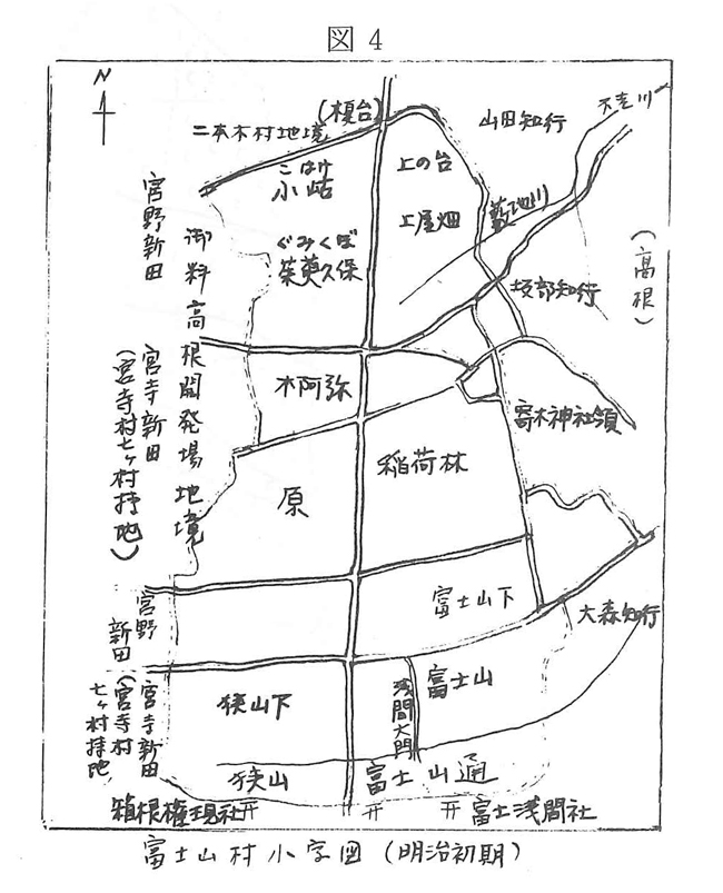
図4 富士山村小字図(明治初期)
Figure 4. A Map of Ko-aza Names in Fujiyama Village (the early era of Meiji)
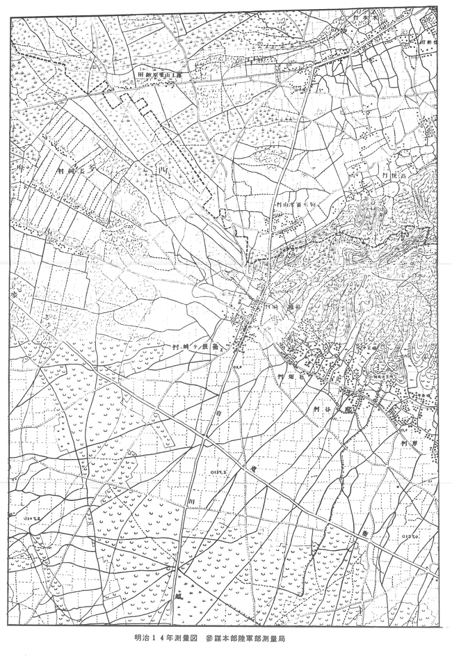
明治14年測量図 参謀本部陸軍部測量局
A survey map made in Meiji 14 (1881) by the Surveying Section, Department of the Army, General Staff Headquarters.
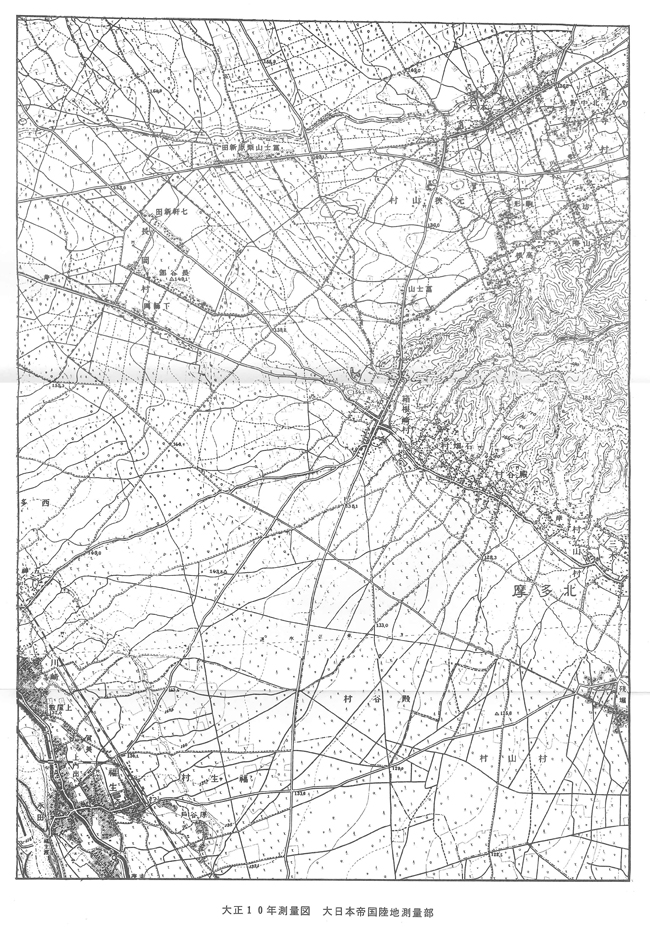
大正10年測量図 大日本帝国陸地測量部
A survey map made in Taisho 10 (1921) by the Imperial Japanese Land Surveying Department.